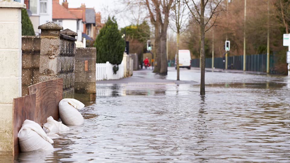
When intense rain falls, the most urgent questions are personal: will water reach my home, will the road remain safe, and how much time do I have to prepare? A rainfall forecast alone cannot answer these questions. The challenge is to translate weather information into a clear picture of its potential impacts and give people enough time to respond.
For urban surface water flooding, this requires an understanding of how rainfall moves through streets, around buildings and into drainage systems, as well as how the resulting flooding affects everyday life. Advances in data, high-performance computing and artificial intelligence are strengthening different stages of this process. This creates a significant opportunity to harness these technologies to provide reliable, detailed flood forecasts and translate them into information that people can easily understand and use to inform their decisions.
One emerging capability is the extraction of flood information from sources that were previously difficult to analyse, for example, by turning news reports into records of flood locations and times. These records could supplement conventional observations where monitoring is limited. However, their coverage and accuracy require careful scrutiny.
Alongside richer sources of information, high-performance computing is making detailed flood simulation increasingly practical. At Loughborough University, our research contributes to this capability through the High-Performance Integrated hydrodynamic Modelling System (HiPIMS). This open-source system accelerates calculations of water movement across cities and catchments (Loughborough University, 2024), supporting the modelling and assessment of urban surface water flooding and its consequences.
AI-based surrogate models offer a complementary approach. By learning relationships from simulations, they can predict flooding more rapidly. Their value, however, depends on their ability to maintain sufficient accuracy under the conditions in which they are used.
Together, these advances create opportunities to update forecasts more frequently and explore multiple possible outcomes. Their practical value nevertheless depends on the performance of the entire forecasting process. Research involving urban flood modelling specialists has identified persistent challenges related to data requirements, model resolution and usability. Data must be collected, predictions generated, and information communicated before decisions need to be made.
Reliable predictions also depend on adequately representing the city. Previous studies have highlighted the importance of terrain and drainage data in urban flood modelling. A model may represent the designed capacity of a drainage system while knowing much less about its actual condition during a particular storm. Blocked inlets, changing sewer levels, kerbs and building entrances can all influence how water moves. A model with a one- or two-metre grid does not automatically have inputs – or produce predictions – of equivalent accuracy. Detailed modelling must therefore be supported by observations and validation before it can reliably inform flood guidance.
Even a timely and accurate flood map requires interpretation. Predicted water depths and arrival times must be connected to at-risk buildings, transport networks and people’s activities. A flooded street has different implications for a commuter, a wheelchair user or someone caring for a relative. Making forecasts personally useful requires an understanding of both the likely disruption and the options available to the person receiving the warning.
These ideas are central to HiPA-Flood, a research programme led by Professor Qiuhua Liang at Loughborough University. Its research plan brings together diverse observations, high-performance modelling, and AI to investigate interactions between flooding, infrastructure, and human responses. Building on HiPIMS, planned demonstrations in Newcastle and Greater Manchester will support the development and testing of these approaches with project partners.
The proposed “AI Flood Mediator” will explore how an AI agent powered by large language models could connect high-resolution flood forecasts and impact assessments with users’ specific circumstances. Through controlled access to verified tools and information, such an AI agent could explain how predicted flooding may affect a particular location or activity, communicate uncertainty, and present warnings in ways tailored to different users, helping them identify appropriate actions consistent with official guidance.
Whether this form of support improves decision-making must be rigorously tested. Evaluation should examine whether people understand the information, recognise its uncertainty, and receive guidance early enough to act. Privacy, human oversight, and accessible alternatives for those unable to use digital services must also inform its development. Working with users and operational partners can help identify which decisions matter most and what may prevent people from responding effectively.
This is where transdisciplinary collaboration, including through Loughborough's FloodScapes network, can make a vital contribution. Engineers, AI researchers, social scientists, emergency managers, and communities bring complementary knowledge about how forecasts become useful in practice. Their shared task is to connect technical progress with a clearer, context-aware understanding of risk, more time to prepare and better-informed action.