Published this week in Science, the international study, led by MBARI Research Specialist Rebecca Englert, could help improve understanding of risks to subsea cables and offshore infrastructure, while explaining how sediment moves from river mouths into deeper water as part of the carbon cycle least well understood.
Professor Daniel Parsons, Professor in Geosciences and Pro Vice-Chancellor for Research and Innovation at Loughborough University, contributed expertise in acoustics to the research. Acoustic monitoring enabled the team to track changes to the underwater slope and the sediment flows it released.
Professor Parsons said: “One of the biggest challenges in studying underwater landslides is seeing what happens as they unfold. Sediment clouds obscure the view, but sound allows us to measure in great detail the changing seabed and the flows above it at the same time. These observations take us beyond examining the scars left afterwards. We can follow a slope progressively giving way and see how it feeds sediment into currents travelling downslope.”
Underwater landslides are difficult to monitor because of their unpredictable timing and submerged location. Scientists have therefore relied heavily on seabed surveys both before and after an event, alongside scaled laboratory experiments and computer models to understand how they happen.
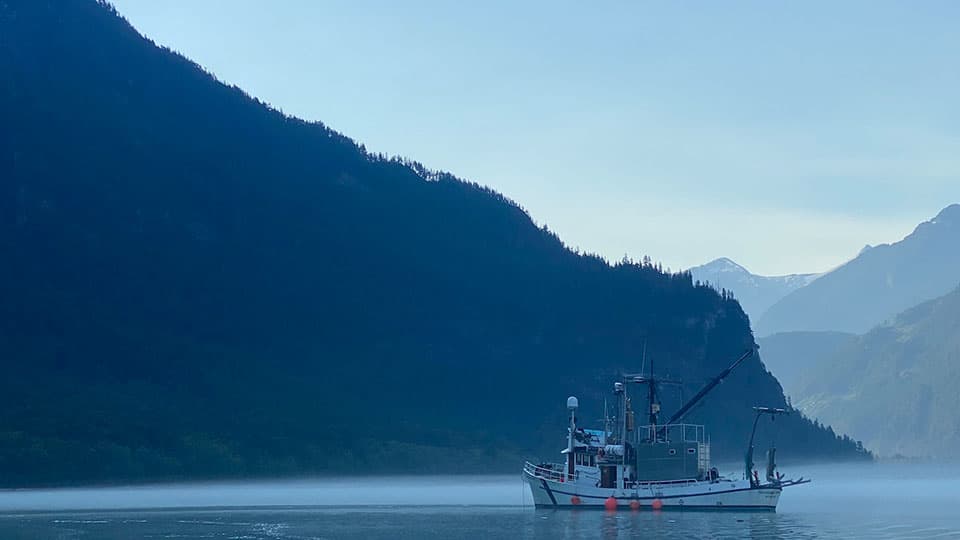
During an 18-day field campaign at the Homathko Delta in British Columbia, Canada, the team combined two sonars beneath an anchored boat with daily seabed mapping and a sediment sensor moored 700 metres downslope. The sonars used sound to image the delta edge and the water beneath the vessel once every second, capturing three landslides in detail.
They revealed a process known as “breaching”, in which a steep face of sand gradually retreats uphill while releasing sediment into currents flowing downhill. Water must seep into the tightly packed sand as it expands and loosens, slowing the failure.
The monitored landslides lasted between 38 and 100 minutes. Further downslope, suspended sediment remained elevated for up to 14 hours, while seabed changes showed that the resulting currents travelled at least two kilometres.
The most detailed record came on 7 September 2022, when a landslide began directly in front of the team’s anchored boat. Over about 40 minutes, the sonars tracked the slope stepping back and a sediment-laden current forming beneath the vessel. Scientists on board heard a noise and saw clouds of sediment and standing waves appear at the surface nearby.
Mapping of the seabed later that afternoon showed that the landslide had removed around 2,600 cubic metres of sediment and cut up to 11 metres back into the delta edge.
Professor Dan Parsons said: “A landslide often brings to mind a sudden collapse that is over in seconds. Here, the acoustic measurements revealed a much more prolonged process. That distinction matters for seabed infrastructure through to the generation and genesis of tsunamis for example. We need to understand how long these events last, how they sustain sediment flows and how those flows erode or bury parts of the seabed.”
The findings have implications for assessing geo hazards like tsunamis through to telecommunications cable breaks and offshore energy infrastructure such as oil and gas or offshore wind. Prolonged failures can expose structures to different stresses from a brief collapse, while the currents they generate can carry sediment well beyond the original landslide.
Across the wider survey area, researchers identified 30 landslides that collectively removed approximately 61,000 cubic metres of sediment from the delta edge. The study also helps explain how relatively small, frequent failures move material from rivers towards the deep sea. That sediment can carry organic carbon into the deep sea alongside pollutants such as microplastics, making its onward journey important for understanding the marine environment.
Professor Parsons added: “Acoustic monitoring gives us a way to test ideas about processes that have largely remained hidden from view. By connecting what happens at the failing slope with the currents it produces, we can improve our understanding of both seabed hazards and the movement of material from land into the ocean."
The international collaboration brought together researchers from universities, geological surveys and marine research organisations in the UK, Canada, the Netherlands and the United States.
The full research paper is available here.
ENDS