Spatial-visual measurement of perceived accessibility
In 15-Minute City
Torah Chen, Asya Natapov, Taimaz Larimian
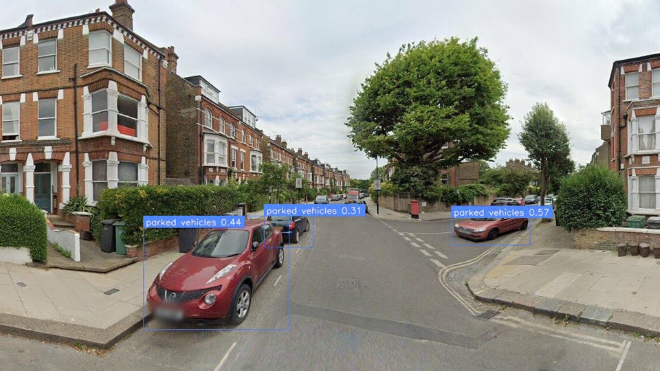
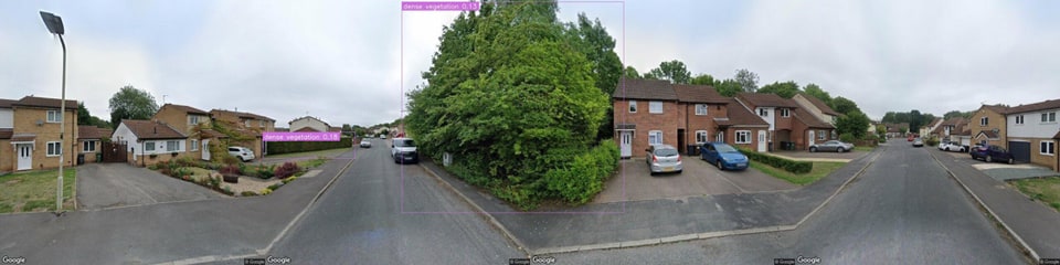
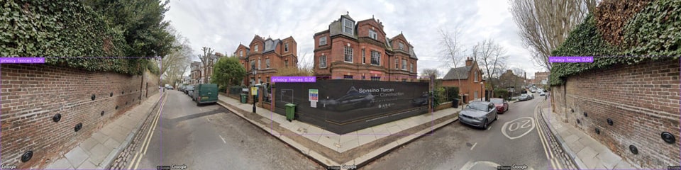
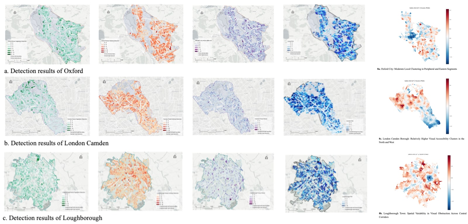
Pedestrian accessibility is increasingly recognised as fundamental to sustainable urban development due to its potential to deliver environmental benefits, enhance public health, and foster vibrant urban communities. This research is situated within the context of the 15-minute city, an urban planning model designed to enable residents to conveniently access essential services through short walks or cycling trips from their homes. However, traditional methods of assessing pedestrian accessibility have predominantly relied on GIS-based spatial network analysis, which often overlooks critical aspects of human perception and the experiential qualities of urban environments. To address this gap, this study highlights the importance of visual perception and visually perceived urban environments in influencing pedestrian movements and experiences, proposing a pedestrian-centred framework that integrates these visual perception elements. The integration of street view imagery with advanced spatial analysis methods represents a significant methodological advancement, enabling detailed evaluations based on visually perceived characteristics of urban spaces. Specifically, the study quantifies visually perceived pedestrian accessibility and explores its relationship with diverse urban environmental attributes. The research employs a systematic literature review to establish the theoretical basis, supplemented by data collection from street view imagery, GIS databases, and demographic datasets. Additionally, a deep learning approach using the YOLO object detection model is applied to systematically identify and analyse visual obstacles within pedestrian spaces. Statistical and spatial analytical techniques are subsequently utilised to reveal variations and patterns across selected case study cities, ultimately providing actionable insights for urban planners and policymakers aiming to create more pedestrian-friendly urban environments.
Publications and presentations
- Assessing Pedestrian Visual Perception Using Open-Vocabulary Object Detection in Urban Street Scenes
- Refining Urban Accessibility Measurement through Street View Imagery: A Pedestrian-Centric Approach
- Measuring Spatial-Visual Accessibility in the 15-Minute City: Integrating Geographical and Visual Information
- Measuring pedestrian accessibility and urban perception: a visually perceived approach to pedestrian space analysis within the 15-minute city framework
- Measuring Spatial-Visual Accessibility in the 15-Minute City: Integrating Geographical and Visual Information