Towards pedestrian-friendly cities
Employing geospatial artificial intelligence for urban planning
Mohamed Shamroukh, Asya Natapov, Taimaz Larimian
This project focuses on advancing pedestrian-friendly urban planning through the development of a robust, data-driven framework aimed at supporting more sustainable and liveable cities. It begins with a systematic review of existing pedestrian monitoring methods, critically assessing their scalability, reliability, and applicability across varying urban contexts. Insights from this review will guide the refinement of data collection strategies, with particular emphasis on improving the accuracy of pedestrian counts derived from WiFi sensors through rigorous validation against field observations. Central to the project is the construction of a GeoAI-based predictive model that combines deep learning techniques with spatial analysis to estimate pedestrian density, flow patterns, and temporal variability. This model will incorporate a wide range of explanatory variables, including environmental attributes and temporal dynamics. The research also identifies and characterises pedestrian hotspots, analysing their spatial and temporal fluctuations while examining key drivers of pedestrian activity such as land use entropy and accessibility. Moreover, it investigates the interactions between pedestrian movement and the built environment, including the roles of street configuration, public amenities, and commercial activity in shaping walkability. The ultimate aim is to generate empirically grounded insights and practical recommendations to inform urban design and planning policies that enhance pedestrian experiences, support economic activity, and contribute to more resilient and equitable urban spaces.


Publications and presentations
- Reliability and Scalability of Pedestrian Monitoring Practices: A Systematic Review
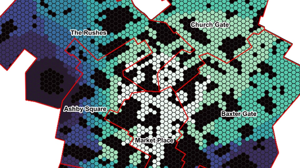
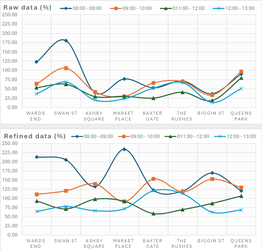
- Spatio-Temporal analysis of pedestrian activity in Loughborough using WiFi data
- From Data to Decisions: Understanding Pedestrian Flow with WiFi Scanner Data
- Data-driven prioritising of pedestrian-oriented infrastructure: A framework for resources allocation
- Mapping Loughborough's Pedestrian Activity Using WiFi data